Residents relieved as flooding remains limited after recent storms

Ward 68 councillor Xolani Diniso out and about in Ezinkomeni informal settlement on Monday June 9.
Image: Supplied
After the South African Weather Service issued weather warnings this past weekend for heavy rainfall, strong winds and possible snow in areas, Bolander followed up on whether the inclement weather has brought with it the usual problems arising in hot spot areas located in the Helderberg basin.
Informal settlements in Sir Lowry’s Pass Village and Strand are annually affected by flooding after heavy rainfall.
The Ezinkomeni and Thulile informal settlements, in Lwandle, Strand, were of the areas where flooding occurred over the weekend.
Ward 69 councillor Xolani Diniso said the heavy rains on Friday, Saturday and Sunday resulted in flooding, affecting residents.
Mr Diniso told Bolander he was alerted to the flooding on Saturday June 7. More than 700 informal dwellings were affected, but presently he said, the residents cannot be evacuated due to shortage of alternative accommodation.
He said the residents could not be taken to the public hall and those who could not access their homes were living with relatives.
On Monday afternoon, Mr Diniso was still assisting affected families together with Gift of the Givers which supplied them with food and blankets.
“There were no serious incidents or damage reported to us, only flooding,” he said.
In Sir Lowry's Pass Village, areas prone to flooding are usually informal areas, Riemvasmaak, Rasta Camp and others, but no cases of flooding were reported.
Kay’s Community (previously named Kay’s Caravan Park) in Strand, is another annual hotspot for flooding and subsequent evacuation after heavy rains.
Tracey Martin, fund-raising manager at Kay’s Community told Bolander on Monday morning that they were surprised that the area had been spared from flooding after the weekend’s heavy rains.
“When we walked down to the river this morning, we couldn’t believe it, the water level is much better than years before and we can only thank the City of Cape Town and contractor Martin and East for the construction work done on the wall at the river.”
The City’s flood alleviation plans along the Lourens River include the reconstruction of riverbanks, building of earth berms and walls to prevent flooding and widening of the river.
Ward 7 councillor Ruth Arnolds in the Drakenstein municipality, which serves areas such as Van Wyksvlei and Weltevrede in Wellington, said on Monday June 9, she had not received any reports of weather-related flooding.
She attributes this to the clearance of the stormwater pipes and drains before the rainy season commenced.
The City of Cape Town and the Drakenstein Municipality were asked to provide more information on any other areas affected by possible flooding, uprooted trees, or weather-related damages in the areas.
However, at the time of going to print, no additional information had been received.
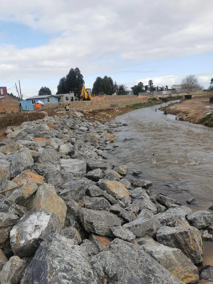
The Lourens River flows past the area adjacent to Kay's Community and in the past resulted in the housing units being heavily flooded. Since the work started as part of the Lourens River Flood Alleviation Project, the flooding has lessened, says Kay's Community representative, Tracey Martin.
Image: Supplied